MULTIMEDIA
Blue marble
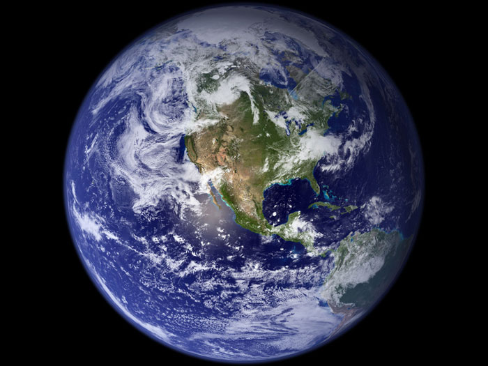
This spectacular 'blue marble' image is the most detailed true-color image of the entire Earth to date. Using a collection of satellite-based observations, scientists and visualizers stitched together months of observations of the land surface, oceans, sea ice, and clouds into a seamless, true-color mosaic of every square kilometer (0.4 square miles) of our planet. Much of the information contained in this image came from NASA’s Moderate Resolution Imaging Spectroradiometer (MODIS) onboard the Terra satellite. Visualization date: August 2, 2002.
Credit
Image and caption adapted from NASA's Visible Earth catalog. Credit: NASA Goddard Space Flight Centerl Image by Reto Stöckli (land surface, shallow water, clouds). Enhancements by Robert Simmon (ocean color, compositing, 3D globes, animation). Data and technical support: MODIS Land Group; MODIS Science Data Support Team; MODIS Atmosphere Group; MODIS Ocean Group. Additional data: USGS EROS data Center (topography); USGS Terrestrial Remote Sensing Flagstaff Field Center (Antarctica); Defense Meteorological Satellite Program (city lights).


