News | February 7, 2022
Practice Makes Preparedness: NASA Participates in North Carolina Hurricane Exercise
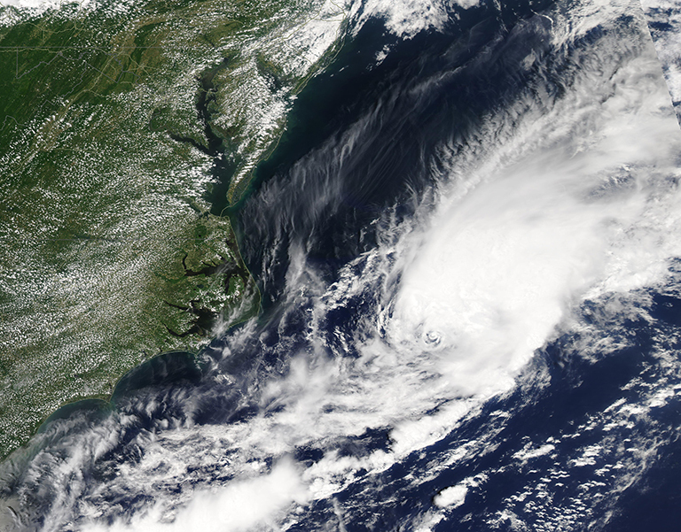
NASA’s Aqua satellite acquired this image of a storm off the coast of North Carolina as it strengthened into Tropical Storm Bill on June 14, 2021. Credit: NASA's Goddard Space Flight Center/MODIS Land Rapid Response Team
Climate change is contributing to increasingly severe hurricanes, with expected increases in rainfall, flooding, and proportion of category 4 and 5 storms in the 21st century. A NASA Earth Applied Sciences team is working with North Carolina’s safety agencies to identify how NASA Earth observations can help inform early disaster response when hurricanes strike.
The NASA Disasters program area team joined the state’s annual hurricane exercise to learn which NASA resources could be most useful during a hurricane or tropical storm event – when every second counts. Resources like NASA’s Short-term Prediction Research and Transition Center (SPoRT) provide crucial data on the ocean environment surrounding a storm, which can provide insights into how strong a storm might get. And following landfall, optical data collected by NASA’s Aqua and Terra satellites can map the extent and severity of flooding.
“To prepare for the increase in frequency and intensity of weather-related events, we can assist North Carolina communities by obtaining and utilizing all available data and technology. Pre- and post-storm satellite imaging from NASA can help with long-term planning and mitigation, and also with damage assessment right after an event,” said Gary Thompson, deputy risk management chief for North Carolina Emergency Management.
Hundreds of participants from the state and county agency level joined first responders and decisionmakers to simulate emergency response and evacuation before, during, and after hurricane landfall, giving the NASA Disasters team insight to develop a customized mapping portal to fit North Carolina’s unique needs.
More details about NASA’s role in this exercise can be found in the story North Carolina Flooding Exercise Strengthens Emergency Preparedness “Muscle.”
View all Earth Science in Action Posts


